SAN FRANCISCO — The Colorado River rises high in the Rockies, near Long’s Peak in the state that bears its name, and begins its 1500-mile, 12,000 foot descent to the Gulf of California. Its waters are sweet. The Colorado’s volume swells quickly from snowmelt, and before long it is a roaring churning violently through red canyons down the long West Slope of the Rockies. Not far from the great Utah desert, near the town of Palisade, the rapids die into riffles and the tempestuous Colorado becomes, for the relatively short length of forty miles, calm and sedate. It has entered the Grand Valley, a small but productive agricultural basin full of orchards and grazing cows looking utterly out of place in a landscape where it appears to have rained once, about half a million years ago. Agriculture in the Grand Valley depends on the river, so a good deal of its water takes an excursion there to irrigate the fields. As the water leaves the river, its measured salinity content is about 200 parts per million. As it returns to the river, the salinity content is about 6500 parts per million.
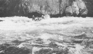
The Colorado flows out of the Grand Valley and disappears into the desiccated canyon lands of southern Utah, which Edward Abbey and a smattering of other living things are content to call home. Near the northernmost tentacle of Lake Powell, the reservoir that backs up behind Glen Canyon Dam, it meets the Green River, which comes down from the Wind River Range in Wyoming. There is irrigation along the Green and two of its major tributaries, the Yampa and the White, so the Green adds salts to the Colorado. Released by Glen Canyon Dam, the Colorado alternately crawls and dashes through the cathedral fastnesses of the Grand Canyon, forms North America’s largest man-made pool behind Hoover Dam, and then, released again, cuts a lonely course through the awesome desolation of the Mohave and Sonoran deserts. Now and then water is taken out to irrigate fields of other worldly green that appear sporadically along its banks, adding more salts, and a few small tributaries enter whose waters have trickled through saline soil in Arizona.
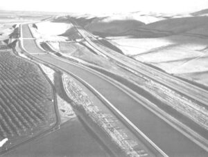
At the southwestern extremity of Arizona is the Welton-Mohawk Irrigation Project, a few tens of thousands of acres sitting along the Gila River, the last important tributary of the Colorado. The area was irrigated off and on beginning in the 16th Century, eventually salted out, and then was revived a few decades ago through some expensive works built by the United States Bureau of Reclamation. Because of poor natural drainage, Welton-Mohawk soon experienced a serious problem: the saline irrigation water collected underneath the soil and threatened to rise into the root zones of the plants. Therefore in 1963, the Bureau built a drainage system for the area, which empties into the Colorado River just above the Mexican border. A few months later, the Bureau closed the gates at Glen Canyon Dam.
With the Welton-Mohawk Project delivering to the Colorado River a liquid that was about midway between slightly diluted seawater and fresh water (its salinity content was 6300 parts per million), and with Glen Canyon Dam drastically diminishing the flow of fresh water going toward Mexico, the salinity level of the Colorado as it entered Mexico suddenly leaped from 800 to 1500 parts per million. An extremely well-managed and efficient irrigation system growing certain salt-tolerant crops might be capable of dealing with such levels of salinity. But the Mexicans, whose level of agricultural sophistication is lower than ours, could not. The most productive agricultural region in their country is just below the U.S. border and relies entirely on Colorado River water, and we were giving them slow liquid death to pump over their fields.
On June 3, 1979, the giant Ixtoc One oil well off Mexico’s Caribbean coast blew out, and before long it had caused the largest, and quite possibly the most devastating oil spill in history. By August the oil began washing up on the beaches of southwest Texas, near important wildlife refuges (including the one used by the tiny surviving nock of whooping cranes) and some of the richest shrimp spawning beds in the world. The United States government pleaded with the Mexican government to help clean up the mess, and the Mexicans told us, in effect, to go to hell. They did so for a specific, and, in their view, entirely justifiable reason. After the salinity levels of the Colorado River went out of control in the early 1960s, the Mexicans had pleaded with the United States to do something, and we told them, in effect, to go to hell. We had signed a treaty with Mexico in 1944 guaranteeing her 1.5 million acre-feet of the river’s water each year – a meagre ten percent of the annual flow – but the treaty, after all, said nothing about the quality of the water. So we did nothing.
However, in 1973, Mexican presidential candidate Luis Echeverria made the salinity of the Colorado River a major issue in his election campaign, and the response was so overwhelming that before long it seemed to be the major issue in his election campaign. When Echeverria was elected, Mexico threatened to take the United States before the International Court at the Hague, and shortly thereafter some new geologic soundings indicated that Mexico might well become one of the biggest oil-producing nations in the world. Echeverria intervened personally with President Richard Nixon, insisting upon a new treaty with the United States guaranteeing Mexico a tolerable level of salinity in the Colorado River, and we signed in three months.
Not long ago I was speaking with Dr. Jan van Schilfgaarde about salinity, and I asked him whether it was likely that an element as commonplace as salt – or, more specifically, the various chlorides, calcides and other reactive mineral compounds that are generically referred to as “salinity”, and are irrigation’s hoariest problem – could have ended desert civilizations in the past. Van Schilfgaarde, who is an elegant man, sardonic, articulate, and European – an unlikely person, somehow, to be running the Department of Agriculture’s Salinity Control Laboratory in Riverside, California – told me that it is hard to say. You run into these cause and effect relationships,” he said. “Will historians say that inflation killed American civilization, or was it a weakness of will that allowed inflation to continue, or was it the thousands of interest blocks that frustrated our efforts to reduce inflation, or was it the insecurity and crime and panic that was the result of the inflation? I don’t know. The literature is full of assertions that salt killed civilizations like Mesopotamia, and I guess you have to take them somewhat seriously, anyway.”
Van Schilfgaarde’s sardonic personality itself poses a question of cause and effect. Did he bring his personality to his job, or is it a consequence of his job? It is his responsibility to solve a simple but unusually stubborn problem which threatens the future of irrigated agriculture and leads to strained relationships with our neighbors (Canada, like Mexico, is furious about saline return flows from U.S. irrigation projects, particularly the mammoth Garrison Diversion Project under construction in North Dakota). Van Schilfgaarde’s laboratory quietly conducts experiments, takes measurements, performs tests, and comes up with solutions which he thinks are sensible, and no one pays much attention. Worse, others come up with solutions which he plainly thinks are ridiculous, and they get the attention, and the money.
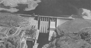
Public Law 93320 is such a solution. Title One of the law, which was passed in 1973, authorizes the Bureau of Reclamation to construct a desalinization plant along the Colorado River which will be ten times larger than any in the world, and a hundred times larger than any in the United States. The plant, which will be located at Yuma, Arizona, is supposed to cost $190 million, a figure which hardly anyone believes, and it will consume about as much electricity as a city of 40,000 people, electricity that presumably will come from the coal-fired Navajo power plant in northern Arizona, which is polluting the magnificent vistas of the southwest. The Yuma plant’s sole purpose will be to desalinize the Colorado River before it enters Mexico. Title Two of Public Law 93320 authorizes the Bureau of Reclamation to spend an additional $600 million of the American taxpayers’ money on a number of structural salinity control measures in the Upper Colorado Basin above Glen Canyon Dam. After the desalinization plant is built and the Upper Basin salinity control works are completed, the odds are fairly good that within two or three decades, the salinity levels at the Mexican border will again exceed our treaty obligations.
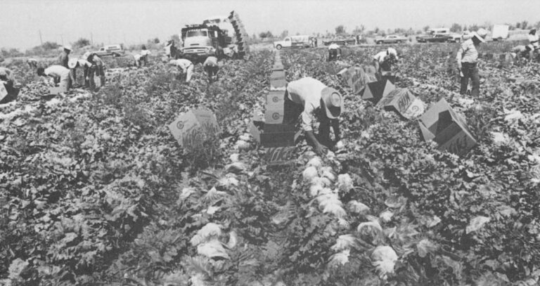
“I don’t know why people have such a hard time accepting good management as a sensible solution to salinity,” says van Schilfgaarde with a note of weariness in his voice. “We have experiments going in which we’re growing crops on good irrigation water, and then reusing the water on salt-tolerant crops such as sorghum, cotton, and barley. That way you gave water and greatly reduce your drainage problem. For a couple of years we’ve had 100 percent yields of cotton irrigated with water that contained 6000 parts per million salinity. The question is can such yields be sustained, but we ought at least to wait a couple of years to find out. The environmentalists want to take the lands that contribute most to the problem out of production, such as Welton-Mohawk. That may make economic sense, but it’s politically unpalatable. The Bureau wants to build monuments which cost a fortune but don’t offend or inconvenience the agricultural interests.”
What the Yuma desalinization plant will do is give Mexico water that costs $300 per acre-foot to purify so that farmers can continue to grow surplus crops with federally-subsidized water that costs them $2.50 per acre foot.
“The Colorado River is only a small part of a much larger salinity problem affecting various highly productive agricultural regions of the West,” says Jan van Schilfgaarde. “The San Joaquin Valley in California has the problem in the extreme, because there you have a shallow and relatively impermeable clay membrane lying underneath, and irrigation water eventually collects and forms a saline swamp. The good water evaporates and the junk water goes down, so the problem gets worse and worse. Only a few thousand acres have gone out of production so far, but that figure is projected to increase drastically within the next few decades. This is the richest agricultural region in the country, and perhaps in the world. Again, I say the solution – perhaps not the whole solution or the longest range solution – is better efficiency. The Bureau of Reclamation says the solution is to build a gigantic, multi-billion dollar drainage system under the valley, and the irrigators want to dump the wastewater into San Francisco Bay.”
The estimated cost of building a drainage system for the Westlands, a small part of the San Joaquin Valley, is now around $500 million. A report was recently issued by a specially-appointed task force which says that a greatly expanded drainage system – much bigger than the one for Westlands – may soon be required in the Valley. It is certain to cost billions of dollars. The farmers in the Valley, one of whom was featured on television recently with his solid gold-appointed Cadillac, are loathe to pay for the drainage system. But the Bureau of Reclamation has an answer to that. One could easily create artificial wetlands with drainage water – man-made swamps filled with pesticides, fertilizers, herbicides, and a plethora of mineral salts which are likely to attract a few flocks of unsuspecting ducks. So a certain proportion of the cost of any future drainage system could be written off as a wildlife benefit.
There have been 1200 dams built in California during the past century and a half, and, except for a few rivers on the North Coast, most of the water in most of the rivers is put to some economically beneficial use – chiefly irrigation – before it is allowed to run out to sea. Nevertheless, about 40 percent of the water used in the state still comes from under the earth. Most of the groundwater is consumed by agriculture in the San Joaquin and Sacramento Valleys, which together, comprise the enormously wealthy agricultural region known as the Central Valley. The Valley ran low on groundwater once before, in the 1930s, after the irrigators had relied on it almost exclusively for fifty years. A series of behemoth dams was built which captured river water and spread it over the Central Valley, replenishing the groundwater tables. Now the Valley is beginning to run low again, and there may be no more distant rivers available to save it.
In the San Joaquin Valley, where the problem is by far the worst, groundwater is currently being overdrafted at a rate approaching two million acre-feet per year — which is to say that, every year some 600 billion gallons of water are sucked out of the ground and not replenished. By the end of the century the figure is likely to exceed over three million acre-feet per year. That is nearly a trillion gallons of groundwater “mined” from the earth, year after year after year. How long this can go on no one knows – it depends upon a number of things, such as the weather and the types of crops that are grown and the price of the energy used to pump out the water – but it is one reason why one hears more and more talk about capturing the Eel, Klamath, and Columbia Rivers.
The problem in California is that there is no regulation over groundwater pumping, and, from the looks of things, there won’t be for another quarter century or so. The problem in states such as New Mexico and Colorado is not that there is no groundwater regulation, but that those appointed to regulate groundwater have, under intense pressure from the agricultural interests, made a conscious decision to exhaust their reserves within the next twenty-five to fifty years.
One of the largest and most important groundwater formations in the West is the Ogallala Aquifer, which reaches southeasterly through eastern Wyoming and Colorado and western Kansas and Nebraska into New Mexico and the Texas Panhandle. On a hydrographic map the aquifer looks a little like a big trough, and the states are lined up along it like cows, sucking it dry. William McDonald, who is head of the Colorado Water Conservation Board, says that, because of the depletion of the Ogallala Aquifer, agriculture in eastern Colorado could “collapse” within twenty-five to forty years. Stephen Reynolds, the State Engineer of New Mexico, says that his state has “made a policy decision to mine out our share of the Ogallala within about forty years.” In the Texas Panhandle, he says, the situation is “already critical”. It costs up to $50 to pump an acre-foot of water there – the more one mines an aquifer, the more expensive is the cost of pumping water – and the irrigators cannot afford to pay more than $20 per acre-foot.
“In Lee County, New Mexico, we’re withdrawing at a rate of about 400,000 acre-feet per year,” says Reynolds, “And the rate of recharge is about 27,000 acre-feet per year. There’s about a 27 million acre-foot resource left in that part of the Ogallala, leaving the bottom third of it as a reserve, so the aquifer is going to be dry, at least in an economic sense, in about forty years, give or take a few.” Doesn’t this mean that the entire economy of the region – and much of the West, for that matter – is going to be drastically affected? “’Drastic’ is a subjective word,” says Reynolds. Well, then, to put it another way, how much of an economic shock will it be to New Mexico to have its major agricultural regions run out of water and turn to dust? “Agriculture uses about 90 percent of the state’s water, and I think it returns 10 to 20 percent of our income, or something like that. So it wouldn’t necessarily be a knockout economic blow. But you’re talking about changing the whole life of a region – a whole society and culture.
“Of course, none of this has to happen at all. You can always decide to build some more water projects.”
More water projects. In 1972, a report was released describing a plan to siphon off 5.8 million annual acre-feet from the Mississippi River below New Orleans and pump it a thousand miles across the plains, up a 4000-foot slope, to the parts of the Southwest which have made a conscious decision to run out of water. The cost would be $20 billion, in 1972 dollars, and the benefit-cost ration would be .27 to 1.0. For every dollar invested, slightly more than a quarter would be returned. “That’s kind of discouraging,” says Stephen Reynolds, “But when you look at the balance of trade, you see that this part of the country produces a very large part of our agricultural exports.”
More water projects. The Central Valley Project in California, the showpiece of the Bureau of Reclamation, the greatest water project ever built, is going to amass a $10 billion dollar deficit over its lifetime, according to a United States government audit. The New Melones Dam on the Stanislaus River will, according to a State of California audit, lose more than half a billion dollars over its lifetime. The Bureau of Reclamation recently changed its name to the Water and Power Resources Service, which is another way of saying that it is going to start building more hydroelectric projects to act as cash registers subsidizing its bankrupt irrigation ventures.
More water projects. Well, that is another story.
©1980 Marc Reisner
Marc Reisner is continuing his fellowship investigation into the Effects of the Federal Government’s Water Resources Policies on the Nation.